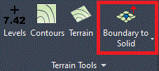

The Boundary to Solid command is available via the Terrain Tools panel.

Purpose
The 'Boundary to Solid' tool projects a boundary on to a TIN surface and then creates a solid - this tool is only available in Autodesk Civil 3D©.
Usage
The Boundary to Solid tool is used to convert flat 2D geometry to a 3D Solid projected acurately onto a TIN surface with a defined thickness. Projecting a flat 2D geometry onto a TIN surface enables elements to be analysed and to be visualised accurately in a complex landscape. Landscape professionals are able to generate planting components from flat 2D geometry that precisely drapes on the projected TIN surface with an associated height for visualisation and impact studies.
Note that a Closed Polyline is required to be projected onto the TIN surface: this needs to have been created prior to running the Boundary to Solid tool.