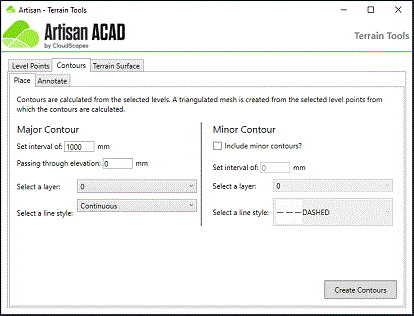

The Contours command is available via the Terrain Tools panel.
Purpose
Users are able to dynamically create Contours from selected Levels. Major and Minor Contours are created with defined intervals, starting elevations, layers and line styles. Contours can be easily annotated with height labels.
Usage
Pick the Contours command to display the Contours tab in the Terrain Tools dialog...

The Contours tools enable users are able to...